 |
|||
| |||
|
|||||||


| Heritage and non Urbex Non urbex related reports and places, but still interesting and photogenic nonetheless! |
 |
|
|
Thread Tools | Display Modes |
  Puffin Island (off Anglesey) Puffin Island (off Anglesey) |
|
(#1)

|
||||
|
||||
|
Puffin Island (Welsh: Ynys Seiriol) (at SH 649 821 or 53°19′05″N 04°01′40″W) is an uninhabited island off the eastern tip of Anglesey, Wales. It was formerly known as Priestholm in English and Ynys Lannog in Welsh. Puffin Island is the ninth largest island off the coast of Wales. It is Carboniferous limestone, at its highest point it is 58 metres (190 ft) above sea level having steep cliffs on all sides. It has an area of 0.28 square kilometres (69 acres). The island is privately owned by the Baron Hill estate and landing is not allowed without special permission. [Note from navigator :- written permission from the Baron Hill Estates office is required before any boat charterer will take you across - Bird breeding season is totally out - They didn't charge for permission but asked that I made a donation to the Beaumaris Lifeboat] History The Welsh name, Ynys Seiriol, refers to Saint Seiriol, who established a monastic settlement on the island and on Trwyn Du (Penmon Point) on the mainland opposite the island in the 6th century. Seiriol is said to have been buried on the island. A monastery existed on the island in the late 12th century and was mentioned by Giraldus Cambrensis who visited the area in 1188. He claimed that whenever there was strife within the community of monks a plague of mice would devour all their food. King Cadwallon ap Cadfan of Gwynedd is said to have sheltered here in around 630 when fleeing an invasion from Northumbria. Llywelyn the Great issued two charters in 1221 and 1237 confirming the canons regular, in possession of the island and the church and manor of Penmon on the mainland of Anglesey. The ruins of several ecclesiastical buildings are visible on the island, including the remains of a 12th century church. Much later a telegraph station was built on the north-eastern tip of the island.[1] It is now disused. [Note from Navigator - the telegraph (semaphore) station was actually only in use from 1839 to 1863 (when electric telegraph replaced it). This brick structure replaced a wooden structure that was built in 1841. its purpose was to transmit messages of ship arrivals to and from Liverpool from Holyhead. It was kept by Liverpool dock board for emergencies until 1866, by which time the electrical system was tried and tested. It then passed into the hands of the estate owner Richard Bulkeley (mentioned elsewhere in this forum - Baron Hill mansion). It was promised to the towns of Bangor, Beaumaris, Conway and Caernarvon that should a cholera outbreak hit the locality, the signal station would become a cholera hospital. From 1887, the university of Wales took over the building, refurbished it and used it as a biological station. The station closed in 1901 (due to completed research, deterioration of the building and lack of funding) and research was transferred to Menai Bridge. Puffin Island has been unoccupied since this time.]  Puffin Island from seaward  Penmon Point on Anglesey from Puffin Island (Low tide) - beautiful area Means of access!  Old monastery and crofters cottage (rabbit hunting was his role) 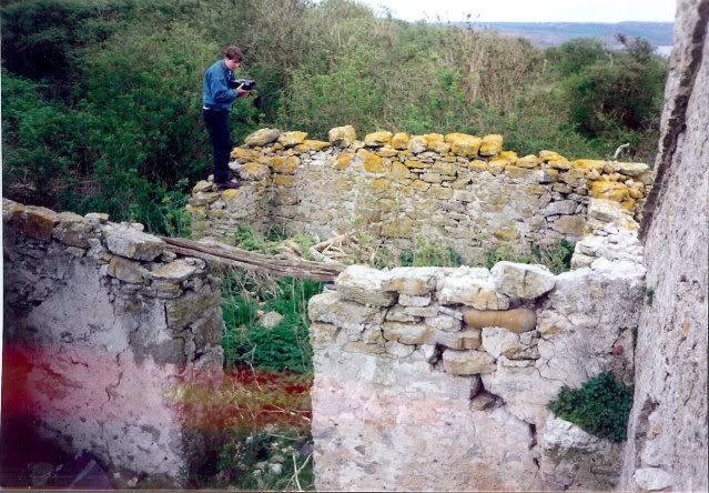 Crofters cottage 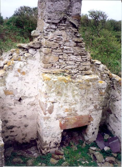 Fireplace in crofters cottage - all stonework comes from original monastery ruins 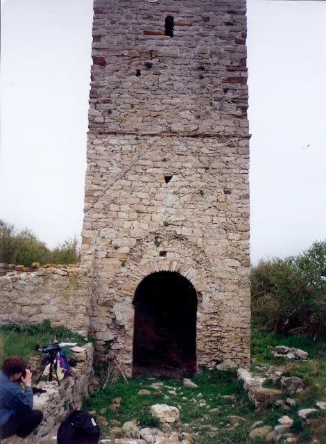 Tower from ruins of the church 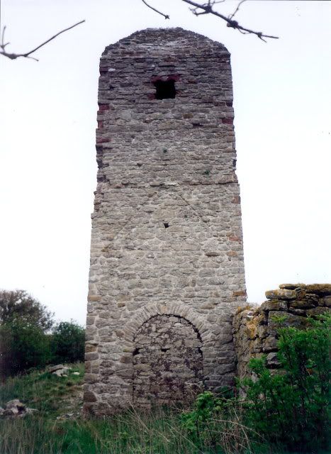 Tower from other side 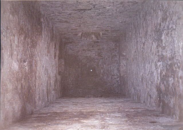 Tower internals - all woodwork gone 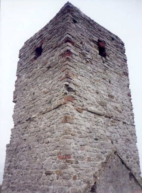 Tower closeup 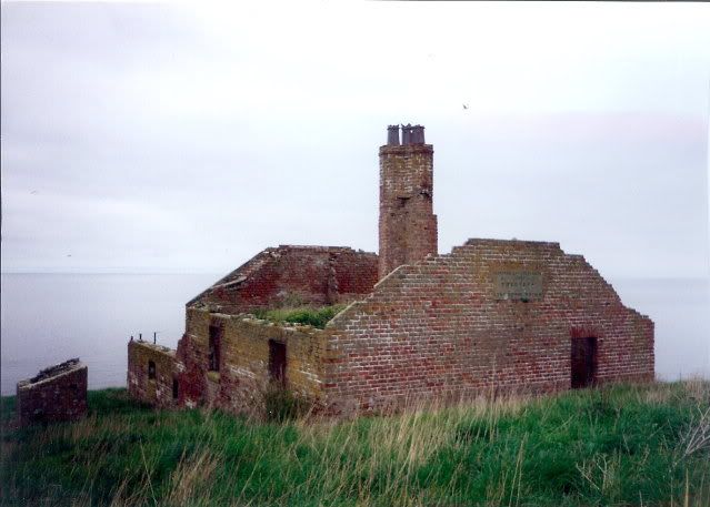 Ruins of signal station - privvy shed to left 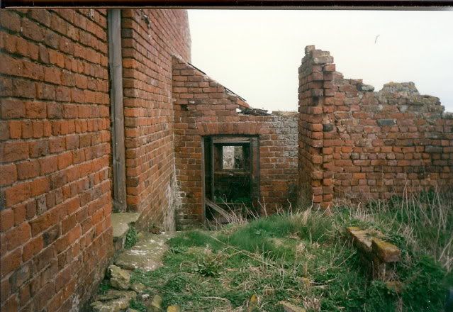 kitchen annex with bakery to right 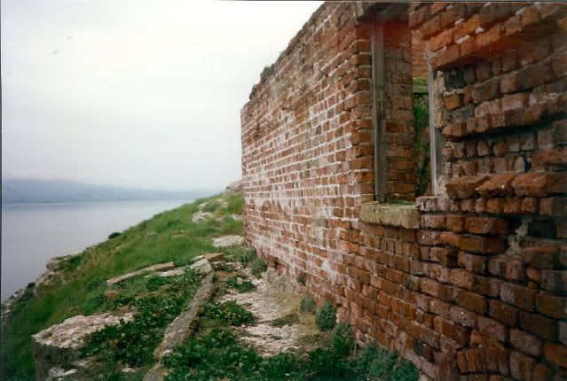 underground cistern for collecting rainwater run off from roof 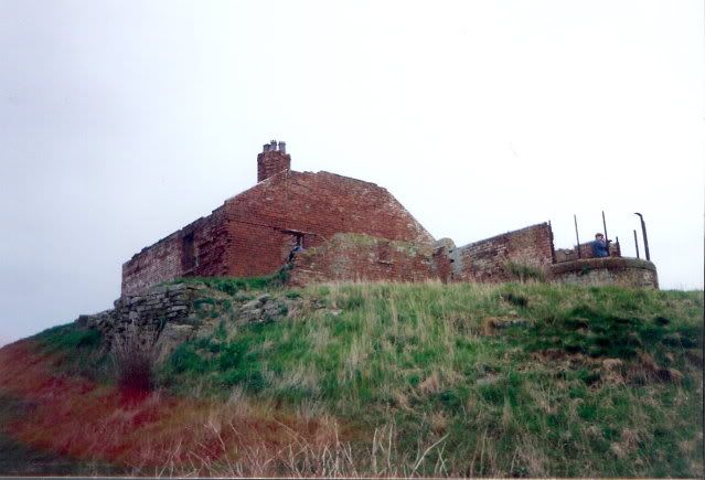 Observatory / signal room 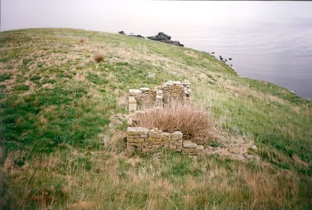 Stables / coal store - pony used to bring coal and supplies from across the other side of island (the only safe landing point)  Turbot Hole - a natural cave system on Puffin Island - cannot be accessed without abseiling equipment - would love to see what's down there Anyone who's really interested in Puffin Island - PM me - I've got all my notes for a Masters dissertation on the history of this island. 
|
||||

| |
|
(#2)
|
||||
|
||||
|
I've always wondered what it was like on the island itself. Thanks for sharing.
Why aren't there any pics of puffins?!
|
||||

| |
|
(#3)
|
||||
|
||||
|
That cave has to be worth an investigation.
|
||||

| |
|
(#4)
|
||||
|
||||
|
This place looks mega

|
||||

| |
|
(#5)
|
||||
|
||||
|
this is good stuff ive always wanted to go here but unsure what would happen if caught on the island without permission.
|
||||
| |
|
(#6)
|
|||
|
|||
|
cool pics i didnt know there was anything on there buildings wise, cave looks interesting,
Quote:
|
|||

| |
|
(#7)
|
||||
|
||||
|
Cracking Asda chocolate biscuits them. Loving the photo's, digital wouldn't give the same feel as these have!
|
||||

| |
|
(#8)
|
||||
|
||||
|
Spot on
 this has been on my list for ages. this has been on my list for ages.
|
||||

| |
|
(#9)
|
||||
|
||||
|
Quote:
|
||||
| |
|
(#10)
|
||||
|
||||
|
Quote:
|
||||
|
| Bookmarks |


«
Previous Thread
|
Next Thread
»
| Currently Active Users Viewing This Thread: 1 (0 members and 1 guests) | |
 Linear Mode

|
|
Powered by vBulletin® Version 3.8.6
Copyright ©2000 - 2024, Jelsoft Enterprises Ltd.
vBulletin Skin developed by: vBStyles.com
Copyright ©2000 - 2024, Jelsoft Enterprises Ltd.
vBulletin Skin developed by: vBStyles.com
© 2008-2015. Photographs and text are copyright and the property of the poster unless otherwise stated, and should not be used without express written permission.
Any opinions stated by users of this forum are NOT those of the site owners, each poster takes FULL responsibility for their own posts.
Any opinions stated by users of this forum are NOT those of the site owners, each poster takes FULL responsibility for their own posts.